News and media
The view from Pakiri Hill
  |
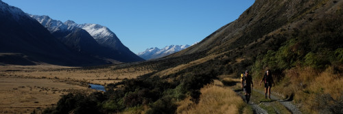
Te Araroa's latest trail runs from top to bottom of Pakiri Hill - about 2 km between Rodney Road at the top end, and Bathgate Road at the bottom. No signage is yet in place on this section. The trail is part of a longer trail planned to head on south across Mt Tamahunga, and right through to Dome Forest near Warkworth, then Puhoi. Signage will go in when the longer trail is in place. But meantime, the Pakiri Hill section is walkable. |
 |
Track development at this stage is simply stiles over fences, and an acknowledgement by the landowners concerned that the route is a legal thoroughfare. We like this trail because it's got great sea views - across to the Hen and Chickens, and Little Barrier. And we like it because from Pakiri Hill you can see Te Araroa's route extending northward literally as far as the eye can see. For from Pakiri, the trail simply follows the east coast beaches as far as Whangarei Heads. There are a few problem spots - one just north of Mangawhai Heads where at present you must road walk because there's no access from the Mangawhai Cliffs Walkway to the Brynderwyn Trail. There's another at the Waipu River, which is definitely not wadeable. |
  |
But north of Pakiri Hill, if you squint a bit, you can see the bigger picture. It's a trail, edged with salt spray, white sand, wading birds, and handy camping grounds. It runs all the way through to Marsden Point and Whangarei. And it's pretty much ready, with a bit of signage, to be joined to the New Zealand-long walking route. If walking the Pakiri Hill track from the top down: walk along the dirt track from the end of Rodney Road, being careful to close one farm gate en route, about 200 metres to where a line of pine trees extends downhill beside an obvious grassy track. Then just follow the fenceline, and the stiles. If walking from the bottom up: the Bathgate Road end has a sign indicating the land beyond is private property, but provided walkers don't stray more than 30 metres or so from the fenceline on the way up and so remain on the paper road, the various warnings on this sign do not apply. Photos by Amos Chapple |
 |
|