News and media
Onekainga open

Photo Fiona Mackenzie
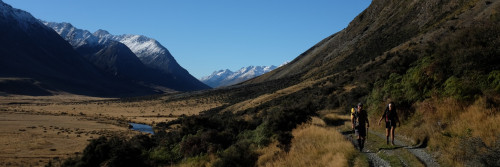
The view from Onekainga
A Te Araroa construction team has completed the 5.5 km Onekainga track leading north from Whananaki.
Whananaki is a well-known estuary community 40 km north of Whangarei.
The track crosses private land, both farmland and protected bush. It's not yet a through route, but is a good stand-alone walk, passing close to the Onekainga summit (227 metres). It finishes two kilometres past the summit, at the edge of DoC's Mimiwhangata Forest Reserve. The track is part of the proposed 20km Te Araroa through trail from Helena Bay to Whananaki.
The entire through trail will be opened once DoC agrees to the route across its Mimiwhangata Forest Reserve, and once negotiation is complete at the Helena Bay end.
Thanks to the ASB Community Trust for funding this track. Thanks to farmers Don Waetford and family, and Craig and Greta Harman. Thanks also to Conservation Volunteers New Zealand, who put much of it in place.

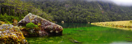
South of Whananaki, the new Onekainga Track links through to DoC's 9km Whananaki walkway. A footbridge, sometimes claimed to be the longest in the southern hemisphere, links the two. The Whananaki Walkway will be signed through with Te Araroa logos by June 30 this year.
Map and text description of the Onekainga Track in the Trail maps section.
![[Whananaki footbridge]](http://www.teararoa.org.nz/userfiles/image/news/Whananaki_footbridge.jpg)