News and media
Dome - Tamahunga track readied.

Te Ngahere at work on the new trail: front to back, Cain Broadfoot, Cain McMillan and Allan Johnson
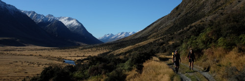
Track construction is now almost complete on Te Araroa's route from the Dome tea rooms on State Highway One through to Govan Wilson Road.
The track begins 7 km north of Warkworth. It follows the Department of Conservation's existing Dome track for 3 km to the Kauri Grove. From there, it follows the ridgeline 3 km to Rayonier's Matariki Forest, descends through a pine plantation to the Waiwhiu Stream and then climbs on a sometimes switchback route through DoC's Totara Peak Reserve, exiting on a 4WD track, then Govan Wilson Road to the foot of Mt Tamahunga.
Contractors Te Ngahere finish construction this week, but the 11-km route is not yet open.
"There's still some surveying, easement documentation, signage and a final pedestrian access from Govan Wilson Road to be done," said Te Araroa trustee Fiona Mackenzie, who did the route-finding, and has been in charge of the project. "We should complete all that soon, and open it this summer."
The track marks a significant co-operation between Rodney District Council, which paid for Te Ngahere's work, the forestry company Rayonier which granted an important access corridor, DoC's Auckland conservancy, the regional Te Araroa Auckland Trust, and Te Araroa Trust itself. Rayonier act as a manager for Matariki Forest which recently purchased from Carter Holt Harvey forestry land that lay astride the walkway route. That deal had to pass before the Overseas Investment Commission and Fiona Mackenzie asked for a designated walkway through the forest land as part of the land transaction. That 2.5 kilometre corridor, mainly on existing forest roads, enabled her to connect the two DoC reserves - Totara Peak and Dome.
"This section of Te Araroa will provide locals with a full-day tramping route almost entirely through native bush - something that's rare in the North Auckland area," said Rodney District's Parks and Coastal Operations Manager Ian Murray. " We also expect that local businesses like cafes, accommodation and camping grounds will gain from increasing numbers of serious walkers in the area."
The new track is part of a longer 28-kilometre route from the Dome tearooms through to Pakiri and Leigh. When the new 11-km track opens this route will be complete, excepting only a 2 kilometre bush traverse on the south side of Tamahunga mountain. Rodney District Council is presently assisting route-finders from Te Araroa Auckland Trust to get access across it.
The northern side of the mountain, through to Pakiri, is already tracked. In 2002, Te Araroa Trust, in co-operation with Rodney District, opened that trail, called Te Hikoi O Te Kiri, in honour of a Ngati Wai chief who had a 19th century pa on Tamahunga summit.
 |
 |
| Checking out the proposed route through Waiwhiu Valley - front to back, Richard Hall (DoC Warkworth), Peter Spencer (Rayonier), Matt Ward (DoC Auckland), Brian Boyd (Rayonier). | Sussing out the best route: left to right, David Wilson (DOC Warkworth), Te Araroa's Fiona Mackenzie, and volunteer David Edge. |